GLORYS
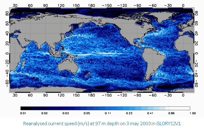
An Ocean Reanalysis is a scientific method that produces a comprehensive record of how ocean properties are changing over time. The outputs of a numerical ocean general circulation model that simulates the evolution of the ocean physical properties are combined objectively with observations to generate a synthesized estimate of the state of the ocean (here the temperature, salinity, current speed and direction, sea level and sea-ice extent, concentration and thickness).
- GLORYS produces and distributes global ocean reanalyses at eddy-permitting (1/4°) resolution that aim to describe the mean and time-varying state of the ocean circulation, including a part of the mesoscale eddy field, over recent past decades with a focus on the period since when satellite altimetry measurements of sea level provide reliable information on ocean eddies (i.e. from 1993 to present).
- GLORYS is a joint effort between Mercator Ocean operational oceanography centre in Toulouse, the academic research community represented by CNRS research scientists and engineers in Grenoble and Brest, the CORIOLIS data centre in Brest and CLS in Toulouse. The GLORYS project is supported by the French Groupe Mission Mercator Coriolis (GMMC), INSU-CNRS and the European Community’s Seventh Framework Programme FP7/2007-2013 under grant agreement n°218812 (MyOcean).
- GLORYS reanalysis project is carried out in the framework the European Copernicus Marine Environment Monitoring Service (CMEMS). GLORYS project also contributes to GodaeOceanview and CLIVAR international programs, the realisation of ocean reanalyses between these two programs being coordinated by the Global Synthesis and Observervations Panel (GSOP).
- The numerical model used is the NEMO OGCM in the ORCA025 configuration developed within DRAKKAR consortium (global with sea-ice, 1/4° Mercator grid). The model surface boundary conditions are derived from atmospheric ECMWF reanalyses. Assimilated observations are in-situ T&S profiles, satellite SST and along track sea-level anomalies obtained from satellite altimetry. The data assimilation method is based on a reduced order Kalman filter using the SEEK formulation.

